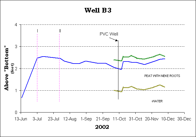

The PVC mat penetration device, Well B3, is located at Station B3 beyond Sta. B2 in an area dominated by neke fern in 2001, but increasingly encroached upon by cattail and para grass.
- The following legend applies to the graph above:
- Vertical lines "I" and "II" mark changes in the water level measurement device: before I - ; I - tape device (see photo at right) used; II - tape device weight modified. Blue line is height of water above the "solid" bottom; green line represents "top of mat" calculated from tape reading from solid bottom to pipe lip; brown line represents "bottom of mat" calculated as "top of mat" minus mat thickness. Vertical line representing well is shown at selected point in time, plotted from the measurements solid bottom to pipe lip.
|
Sta. GPS: Date installed: Pipe length: Ext. above mat: Mat thickness: Under mat: |
June 2002 2.69 ft. 0.92 ft. 1.40 ft. water |
In this location, a layer of water about 1 foot thick is found beneath the vegetation mat. The mat is clearly floating. Note that the neke mat floats higher than the the organic soil with cattail at Sta. B2.