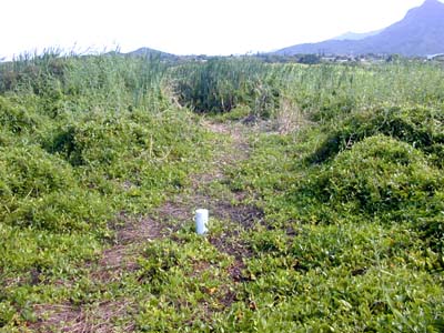

The PVC mat penetration device, Well A1 at Sta. A1, is located a short distance east of the open water ponds restoration site at Na Pohaku o Hauwahine. The vegetation in this area is dominated by maile pilau, para grass, and small, disconnected patches of cattail (background). The suerface has a slightly spongy feel underfoot, and shallow pools of water appear in depressions during wet periods.
- The following legend applies to the graph for Well A1 above:
- Fine dashed line is the water level recorded at the Na Pohaku wetland ponds, not surveyed to the same base elevation as the other levels. Blue line is the measured height of water above "solid" bottom. Green line represents "top of mat" calculated as the tape reading from solid bottom to pipe lip minus extension of pipe above mat. The dashed brown line represents approximate boundary between dark, peaty muck, and deeper muck based upon a single measurement of thickness of the peaty-muck layer. It is assumed that this layer does not change in thickness, although this may not be a correct, still requiring further investigation.
|
Sta. GPS: Date installed: Pipe length: Height above mat: Mat thickness: Under mat: |
Aug. 10, 2002 0.96 ft. 1.05 ft. muck w/ straw |
Well A1 describes the Standard "Wet Meadow" Model. Although a clear rise in water level occurs following a rainfall event, the marsh surface itself rises only a small amount. Indeed, changes in marsh surface elevation may reflect wetting with expansion and drying with contraction of only the peaty layer. It is not really known how the boundary between the peaty-muck and deep muck behaves. Thus, the dashed brown line may not correctly represent the boundary between the layers. In these measurements, the thickness of the system described is determined in total by the depth to which a weighted line sinks through muck.
Note that following the rainfall on October 15, the soil saturation zone rose to a point where water appeared briefly on the surface (this was observed). Afterwards, water level drops, although the marsh surface itself declines (maybe contracts) less quickly. Water level changes are magnified in comparison with water level changes in the nearby ponds(fine dashed line), because the well measurements are made in an aquifer: inputs and withdrawals occur in voids in the surrounding material so the same amount of input will raise the aquifer level more than the nearby pond level.
The dry season change in water level represented by measurements made between August 15 and October 11, 2002 (dry season WL decline) was -0.009 ft/day (-2.7 mm/day).