More recent water level data are plotted elsewhere: CURRENT PLOT.


Historical Water Level Measurements
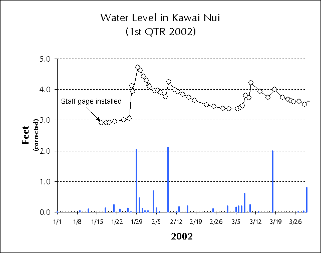
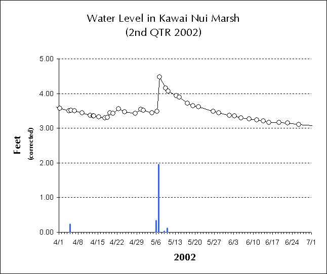
| These graphs show water level in Kawai Nui marsh measured by manual reading at a staff gauge located at Na Pohaku o Hauwahine from the time the staff was first set up in January 2002 through September 2002 (9 months). Note that, although the height scale is arbitrary because the gauge has not been tied to a bench mark of known elevation, comparison with a USGS gauge on the far side of the marsh allows us to apply a correction factor which puts the arbitrary scale elevation within a few inches of the true elevation above MLLW. |
All of the sharp rises in water level correspond to heavy rainfall periods.
Rainfall is monitored at Na Pohaku o Hauwahine; however, water level in the marsh generally is dependent upon rainfall in the much wetter upper watershed (Maunawili Valley). Water flows slowly out of the marsh between inputs from these periods of brief, heavy rains.
More recent water level data are plotted elsewhere: CURRENT PLOT.
|
|

|

|