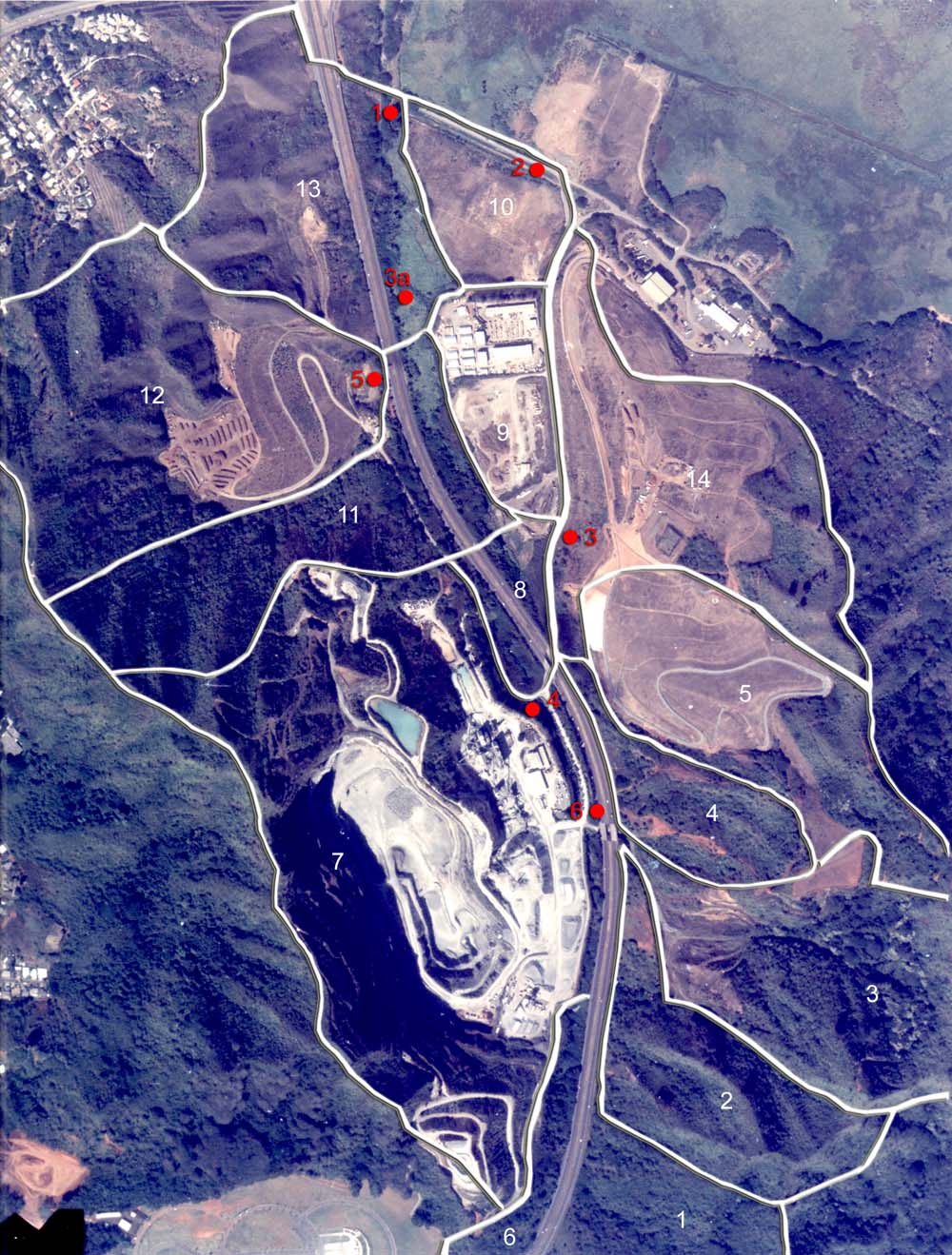
| North is towards the upper left corner on this aerial photograph of Kapa`a Valley. Sub-basins are outlined in white and water quality sampling locations are indicated by solid red circles. Kawai Nui Marsh occupies much of the upper right corner and the "Saddle" road connecting Kaneohe Bay Drive and Mokapu Boulevard appears in the upper left corner. | ||

|
||
| At the bottom of the photograph can be seen part of the Hawaii Veterans Cemetery in Kane`ohe. Construction activities in the lower left corner are an expansion of the nearby Hawaiian Memorial Park, dating the photograph to the time period of the Kawa Stream TMDL (1999). | ||
|
[PREVIOUS PAGE: Kapa`a Sub-basins] | [NEXT PAGE: Kapa`a Stream] [KO`OLAU NET] | [AHUPUA`A] | ||
|
SOURCES: | ||